
BLUEGEM
Biosphere and Land Use Exchanges with Groundwater and soils in Earth system ModelsOverview
People
Science
Domains
Agenda
Production
We focus on three innovative objectives:
- Objective 1. Establish the fingerprint of GW-SM interactions and irrigation on global and regional climate, water resources, biosphere, and soil carbon pools.
- Objective 2. Provide improved projections of global and regional climate, water resources, biosphere and soil carbon pools, fully taking into account the influence of GW irrigation and GW-SM interactions.
- Objective 3. Integrate local and regional knowledge and expertise as well as socio-economic data to refine the land use and irrigation scenarios used in state-of-the-art climate projections (CMIP6) and to explore pathways for sustainable CZ management.
To this end, we combine advanced numerical modelling of biophysical and social systems, as well as participatory methods:
- To quantitatively assess the influence of irrigation and groundwater on climate and critical zone processes, we use global simulations by two state-of-the-art ESMs used in CMIP6: IPSL-CM6 and CESM2, with a horizontal resolution of 2.5°x1.25° and 1.25°x0.9° respectively. The corresponding land surface models, namely ORCHIDEE and CLM5, describe the dynamics of the biosphere and soil carbon, and represent groundwater-soil moisture interactions and irrigation.
- In addition to global ESMs, we also run high-resolution land-only simulations in two focal areas (France and Lower Mekong River basin), to more realistically reproduce the water fluxes and storages than global simulations, and be used in the tasks of the social dimension.
- In France, we will also carry out integrated assessment modeling of the groundwater / land use / irrigation nexus under climate change, owing to the AROPAj agro-economic model of European agricultural supply.
- BLUEGEM also strongly relies on participatory research methods, to engage local communities in the design and implementation of the project’s research activities, and also as an effective vehicle to disseminate research results. Three participatory research methods will be used:participatory GIS, participatory cultural mapping, and storylines.
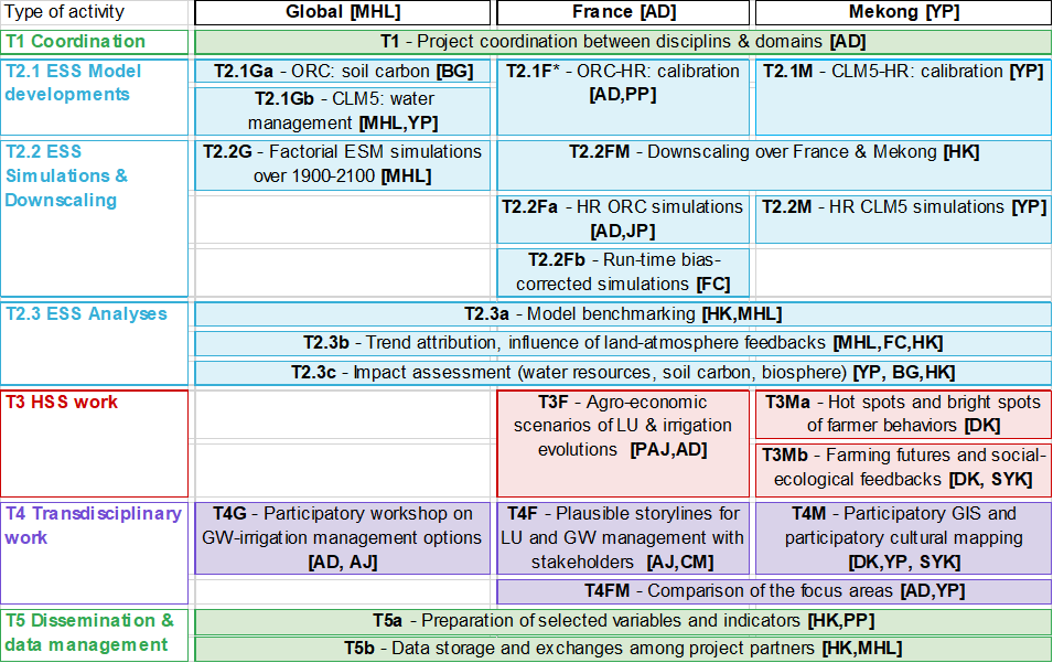
- Geographic domain: global, France, and Mekong (G, F, and M respectively),
- Disciplinary work: Earth system science (ESS) in blue; Human and social science (HSS) in red; transdisciplinary work in purple; transverse activities in green.
Find out more in our proposal.